Surface: Mostly rocky single-track with ledges; steep and unrideable sections
Even though there are quite a few sections in this ride that are almost unrideably steep or rocky, with careful planning it is still possible to at least climb on smooth single-track most of the time. While all of the other trails are unrestricted, the most desireable downhill route is closed to bikes every other day, and can never be ridden uphill, so make sure to check the website and plan your route before going. The only way up leads first to a loop with a crossover trail, where multiple variations of the two loops are possible without having to ride in circles. Next, follow the switchbacks on the west side down into the gulch. Make right turns at every intersection all the way down and back up again to the end of the trail. While there are several options for the final descent, the best choice is to turn right into the forest at the first intersection and join the one-way, bike only route that leads all the way to the bottom.
Surface: Smooth single-track with sand; dirt roads
This ride is comprised of the smoothest single-track trails in the Buffalo Creek area, and even though they are connected by old roads, plagued with sand, exposed by a huge burned area, are in no way technically challenging, and unavoidably finish up with a long climb, they still add up to a lot of fun. Of course, this is because the best way to have fun on a mountain bike is to go fast, and these narrow, twisty single-tracks absolutely demand to be ridden as fast or faster than you will be able to maintain control. There are no shortcuts, and turning around is not likely to be any faster or easier than continuing around the loop, so don't get so carried away that you forget to keep some energy in reserve for the final climb. Start in the small parking area where the second trail crosses the road, and follow the trail to the right. Because a section on the west side is the downhill for another trail, and another on the east side is steep, clockwise is the best way to ride the loop.
Surface: Mostly rocky single-track with ledges; steep and unrideable sections
This trail doesn't seem that difficult in theory, but in practice, the endless climb with numerous sharp, steep switchbacks and short rocky sections all conspire to make it so. As usual, the bulk of the trail is on the outside loop, but the best combinations of climbs and descents are on opposite sides. Fortunately, there is a crossover trail in the middle that not only solves that problem, but also happens to be one of the best, fastest segments of the whole ride, and well worth riding twice. Start out clockwise, cut across the middle, and make the long zig-zag climb counter-clockwise to the side trail, which leads to the peak. No matter how tired you are, don't skip the short ride to the top, as the view to the east is fantastic, and the trail is only rocky and nasty for a short distance at the very beginning. On the way back, continue around the loop, cut across the middle again, and finish clockwise at high speed through the meadow.
Surface: Mostly smooth single-track with rocks; steep sections; dirt roads
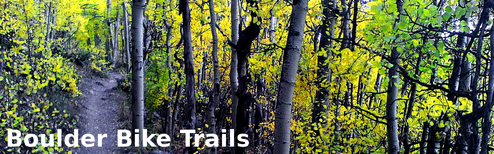
The recent addition of a second loop, along with ongoing improvements to the section leading up from the canyon, have slowly transformed this trail from being little more than a quick ride close to Boulder to one of the best in the area. Consequently, the two rules that were put in place many years ago to reduce conflicts between bikers and hikers have become more important than ever, with one now arguably more beneficial to bikers than hikers. Closing most of the trails to bikes twice a week obviously only benefits hikers, but by also establishing which direction the loops can be ridden, the full potential of the downhills can be more safely realized. While signs at every access point and intersection make these restrictions obvious, it is probably better to visit the official website or follow the rangers on Twitter, to get the most recent information. Park on the east side of the tunnel in Boulder Canyon, and ride up from there for a steep climb that might require a few rests stops, but surprisingly almost no walking.
Surface: Mostly smooth single-track with roots and rocks; steep sections; dirt roads
Unlike some of the other rides that follow portions of Segment 6 of the Colorado Trail, this one is not plagued by endlessly steep grades, nasty technical sections that can draw down your endurance, or six hours of both. While there is considerable elevation gain along the way, the grades are so gradual as to make even the longest climb as rewarding as the best downhill. Though some riding has to be done on roads, none of that precious altitude is ever wasted on anything but narrow single-track. In fact, it seems like your efforts are repaid with interest, in the form of some of the fastest, most exciting downhills you will ever find. Make a loop in the middle by turning left at the first intersection, and rejoin the main trail later on for the final ascent to the top of an unnamed mountain. There is no specific place to turn around, but it is best to avoid going down the other side, as that is part of another ride. Pay attention to branching trails, as a wrong turn could take you to Keystone.
Surface: Smooth single-track; steep, rocky, and unrideable sections
Built only a few years ago, this trail has everything riders of any skill and fitness level could want, with the added bonus of incredible, previously unavailable views of Clear Creek Canyon, and all without enduring the long drive to a segment of the Colorado Trail. The full trail system consists of over ten miles of single-track, the ends of which are connected by dirt roads covering less than half that distance, allowing those who can't manage a ride of over twenty miles with huge elevation gains, to ride a shorter loop. Additionally, three access points also allow riders to match their ride with their fitness level by skipping an initial climb or by riding smaller parts of the trail on different days. However, serious riders will save this trail until they are in shape, start at the bottom, skip the roads, and ride the single-track in both directions. Be sure to visit the Official Website, as there are certain days of the week during which bikes are not allowed.
Surface: Mostly rocky single-track; steep and unrideable sections
While the location alone might be enough to dismiss this trail as being too short and steep to be any fun, the climb is actually no more difficult than any of the other trails in the area. There are a number of painfully steep sections near the bottom, and a few more higher up, but most of them can still be ridden on the way down. The trail improves significantly in the middle, where it traverses the slope above the gulch, although it will become rocky again in the trees near the top. The overlook where the trail crosses pavement for the second time may seem like the end, but there's still another mile of continuous climbing through dense forest to get to the top. While the visibility is good enough to allow a fast descent without hitting anybody, the trail is so narrow that it will be necessary to stop a lot during times of peak usage. Because it starts on a bike path, there is no established parking area, but the trail is prominently marked.
Surface: Mostly rocky single-track; steep and unrideable sections; dirt roads
This trail traverses four different parks, three of which are maintained by Denver Mountain Parks, and the other by Jefferson County, in which all of them reside. It starts out as a wide path near a creek, passes through a complex of trails, many of which are not open to bikes, and then climbs almost continuously to the turn around point. While it might seem that the multitude branching trails along the way are begging to be explored, the only real choice is a climbing loop near the beginning. It could also be considered to be near the end, since the entire trail has to be ridden both ways, but few will be willing to start another climb at that point in the ride, after having spent so much time climbing already. Besides the long climbs, a few tight switchbacks, and the occasional rock paved incline, there is nothing here that is particularly difficult, either technically or physically, which means there will be a lot of fast riding and very little need for resting.
Surface: Mostly rocky single-track; steep and unrideable sections; paved roads
There are two important things to consider before riding this trail, and they are almost mutually exclusive. If it's hot, or there is any chance of rain, you might want to wait for another day. The first is all about exposure, which is common, but the second has to do with the surface of the trails, which will turn into a sticky, slippery mess after even the lightest rain. You can still ride, but climbing is almost impossible, and descending is treacherous. There are three loops here, two of which are made up in part by old roads, and connected by single-tracks. At their best, the roads are basically wide single-tracks, but at their worst they are insanely steep and rocky. There is no avoiding them though, and the good parts far out number the bad, so by riding the loops with the steepest sections on the downhill, the amount of walking can be minimized. Start at South Valley Park for a longer ride, and to enjoy some gradual single-track before tackling the worst road.
Surface: Smooth single-track with sand; steep, rocky, and unrideable sections
This ride starts a little less than two miles east of the Lost Creek Wilderness Area, and follows the last few miles of Segment 3 of the Colorado Trail, which without the creative routing presented here might otherwise be overlooked. As you ride east at high speed, on twisty single-track, with gradual climbs and descents, you will be reminded to pace yourself so that you can enjoy the same thrills on the way back. Turn left at the intersection where the terrain starts to drop off into a valley, cross a road and begin a loop where two other trails meet at a small parking area. Take the trail on the left and make all right turns until you return to that spot. The loop can be ridden comfortably either way, but there is a particularly good section in the middle of the loop that is shared in the other direction on another ride, so plan accordingly to keep from missing out on all it has to offer. If you are up to it afterwards, consider riding to the wilderness boundary and back, as it is also a very nice trail.
Surface: Mostly rocky single-track with roots; steep and unrideable sections; rocky roads
The most challenging aspect of this trail is that it connects two passes, the second one of which is over a thousand feet higher than the first, and with the lowest point located in a valley between them. While this means there will be many alternating climbs and descents spread out over a long distance, it also means being tired throughout the entire ride. As resting takes a lot of time, and the high altitudes seem to require even more effort to get going again afterwards, completing the entire ride can be a challenge for anyone. To increase your chances, save this one for the fall, when the leaves are changing, the air is cool, thunderstorms are fewer, and you are in the best shape of the year. Make a loop at the far end, near Jefferson Campground, by departing from what has so far been Segment 6 of the Colorado Trail, and riding up to the pass where the trails reintersect. The advantage of this route is that it has a more gradual climb and rideable surface, saving the steeper, more complicated section for the downhill.
Surface: Smooth single-track; rocky and steep sections; rocky roads
The only reason this ride isn't both technically and physically easy is because of all the climbing that has to be done to connect the trails. There are some rocks, but nothing that will require more than the most basic skills to negotiate. Of course, serious riders don't mind any of that, and will try to ride all of the available trails, no matter what the grade or surface. However, because this trail is so accessible, be prepared to yield to a lot of novices who like to ride back and forth on the flat sections, walk up the single-track and ride down the roads, and stop when they see too many rocks. The loops can be ridden in any direction as far as rideability goes, but a lot of creativity is required to include all available trails, while repeating only the best ones and avoiding the roads at all costs. Keep in mind that this mountain is essentially just a bump on the plain, with no cover whatsoever, so it will be both hot and a perfect target for thunderstorms.
There is no question that this is a nice trail, but unless it's a really hot day, it might seem to be disappointingly short, even after riding the loop on top in both directions. The trail starts out relatively flat and smooth, but becomes increasingly steep and technical as it approaches the first high point. Unlike some trails, where the main technical challenge is to remain moving and upright through a jumble of loose rocks on steep inclines, this one mostly requires riding over big rocks and negotiating sharp turns, which in many cases may seem to be impossible at first glance. While there are plenty of plenty of sections that are indeed impossible to anyone without a lot of skill and no fear, even an average rider can at least try most everything on the way up, with no real consequences as long as they can get out of their pedals quickly. A shorter and less risky route is available on the north side of the mountain, but as parking is limited at the trailhead, it might be necessary to park in Lyons and ride up the road.
The recent addition of a new trail segment has doubled the length of this ride, but since it was already too short, and there are so few long trails in the area, it is better to make this one challenging ride, instead of two easy ones. Start on the south end, even though far too much riding has to be done on a dirt road at the beginning, and make all left turns down to Lyons. Ride back the same way to the overlook, and then take trail on the left, which is the only trail remaining that you haven't ridden, except for a short connecting segment to the left at the next intersection, where you will go right. While not particularly technical, there are a lot of sharp rocks protruding from the trail at the top, which some might decide to walk through because they look so intimidating, but are not actually that difficult to negotiate. While this trail will always be rocky, it is constantly being improved with creative design techniques that protect it from both heavy use and the damage caused by skidders.
Surface: Mostly rocky single-track with roots; steep sections
Considering the long drive, it would be really nice if this ride, which follows the last half of Segment 5 of the Colorado Trail, was a little longer, but due to the location of the Lost Creek Wilderness Area, and the lack of branching trails, that isn't possible. The road and parking area, beyond which bikes are not allowed, is also a mile from the actual wilderness boundary, but not being able to ride any further is really no great loss. This is a good ride to save for the fall when it's cool, the leaves are changing, and there is no real need to push hard to get in shape like earlier in the year. There are numerous views and aspen groves along the way that invite stopping to look around, and will take up enough time to make it seem like a longer, but more relaxed ride. Looking around while riding won't be a problem a lot of the time either, as with the exception of a few steep, rocky sections, only one of which might force you off your bike, the trail is almost equally rideable in both directions.
This ride combines trails from several relatively short trail systems into almost twenty miles of single-track, with very little time spent on connecting roads. There are four official trailheads with all the usual ammenities, and as many more that offer only a place to park, but some of them have entrance fees. Because the best route involves riding all of the perimeter trails, along with the spurs on the east side and the loop on the west side, none of which have any significant climbs, there is no reason not to start at the most convenient trailhead to minimize drive time. Even though there are plenty of large bushes along the trail, and a few trees on the west side, there is very little real cover from the weather, especially when crossing long expanses of relatively flat terrain, so pay close attention to the weather. Since it's not uncommon for some of the trails to be temporarily closed due to mud, checking the website after any bad weather is also a good idea.
Surface: Mostly rocky single-track; steep and unrideable sections; paved and dirt roads
The surfaces on this trail range between smooth and almost unbearably rocky, but they alternate back and forth enough that the worst sections, on which you will have to weave around large rocks, descend steep sections with ledges, and bounce over pointed rocks imbedded in the trail, won't become too tiresome. Starting on the other side of the ridge from the real parking lot allows riding up and down the nice zig-zag that otherwise has no purpose. Ride clockwise to avoid walking up the nastiest section, and to set up for the parallel trails in the middle without having to walk up the steepest, rockiest switchbacks. To accomplish the latter, take the lower, rockier trail around to the more rideable switchbacks on the north side, and then ride the upper section out and back. There are a lot of intersections along the way, and several paved roads that have to be followed to the next segment, so look for signs and refer to the map to help find your way.
Surface: Smooth single-track with sand and roots; steep and rocky sections
This trail follows the first half of Segment 3 of the Colorado Trail, with a separate loop on one end. The loop is a long, completely rideable climb, followed by a fast, twisty downhill, and the rest of the ride is up and down, with an overall descent towards the end with the loop. Since few would argue that finishing a long ride with a climb is nowhere near as fun as a long downhill, the best place to start is at the bottom, even though it is a longer drive. Ride the loop first, since it has the most climbing, in a counter-clockwise direction to avoid back tracking, and then join the main trail. There are a lot of intersections along the way, so be careful about blasting down the wrong trail just because it was the first one you saw. The loop is the only one to the south, and the rest lead down to the road and are clearly not a part of the main trail, but that might not be obvious at high speeds. As you ride, keep in mind that all those nice downhills will be climbs on the way back, so set a sustainable pace.
Surface: Mostly smooth single-track with roots; steep and unrideable sections; rocky roads
While there are not that many technical sections on this trail, and none worse than what one might find on other trails in the area, the consequences of making a mistake here are far greater, like falling down a steep incline into rushing water. The initial portion of the ride is smooth single-track that winds through the trees near a stream, with the the steeper, rockier sections, coming further along. It might seem that the fun will be over at that point, but everything can be ridden down, and there will be no extended bike pushing on the climbs. Turn left at the horrible looking single-track, even though the road you just climbed is smoothing and flattening out, and look for a trail that branches to the right. That trail will end at a road that will take you out and back to the right, and upon your return, after passing the rocks that give the trail its name, to another single-track that branches off to the left. If you do it all correctly, you will soon see that you have been there before.
Surface: Smooth single-track with roots; steep, rocky, and unrideable sections
Though several of its neighbors are close, with a turn around point at over 11,800 feet, this trail is the highest described here. That fact, coupled with an initial climb that is uncharacteristically rocky compared to the other three rides that are a part of Segment 6 of the Colorado Trail, might send less adventurous people riding in the other direction. But by doing so, they will not only miss out many miles of smooth single-track, but also the spectacular views from above treeline that few other trails can match. The climb to the turn around point is unrelenting, seemingly without any opportunities to rest without stopping, but negotiating all the rocks and roots at the beginning is the only potentially exhausting section, especially for those who don't have an energy reserve. Aside from that, anyone in reasonably good shape will have no problem reaching the top without stopping. No matter what your physical condition, the return trip is the real payoff, and it will be over far too quickly.
Surface: Mostly smooth single-track with ledges and rocks; steep sections; dirt roads
The only thing wrong with this trail, if it can be considered a fault, is that the initial climb is so long and exposed. However, the grade is gradual and the switchbacks wide and rideable, so the greatest challenge is really to endure the constant, direct sunlight and the stiffling heat radiating off everything. At the top, there are several loops and branches connected by roads, all of which are mostly smooth and have plenty of trees for cover. The loops can be ridden in either direction, as the few steep or rocky sections are equally distributed. The ledges that accompany the steep sections look quite intimidating, but most of them are negotiable once you know how, so give them a try and don't just assume you can't ride over them. Take the horse trail at the top, otherwise you will have to carry your bike up or down a stairway. Be sure to explore all of the trails at least once, because there are ruins and other interesting things to see, even if they aren't that fun to ride.
Surface: Smooth single-track with sand; steep sections; dirt roads
The most recent addition to the Jefferson County trail system is a ten mile extension from Reynolds Park, which is otherwise closed to mountain bikes, down to the Platte River. Even though there is over a thousand foot difference in elevation from end to end, it still requires a surprisingly similar ammount of effort to ride in both directions. The steepest grades are on either side of the high point of the trail, particularly within the two miles between the high point and the upper end. There is a side trail that can be ridden counter-clockwise to avoid the steepest climbs, but the elevation changes are nearly the same on both legs. In contrast, the grade is so gentle near the bottom, where the trail clings to the canyon wall above the river, that it is sometimes not obvious whether the overall trend is up or down. Starting at the bottom of any long ride is almost always the best choice, and that is no less true in this case, but doing so will require a much longer drive.
Surface: Smooth single-track with sand; steep and rocky sections; dirt roads
This ride only utilizes a fraction of the trails in the area, all of which are as good or better than any you will find elsewhere, but their configuration makes it difficult to avoid a lot of road riding to connect them. For that reason, there are three other much longer rides described separately, that along with this one, include all of the available single-track, and only as many roads as needed to tie everything together. Start out on the old railroad grade and turn left at the second bridge, where the only trail that allows bikes leads straight ahead into a small canyon. The first intersection is the bottom of a large loop that contains both the long initial climb and high speed descent. Counter-clockwise is probably the best way to go, as this puts the sand that makes braking difficult on the climb side. The loop at the top is relatively short and flat, with lots of twists and turns, making it perfect for riding both ways, and to keep the ride from being too short.
Surface: Smooth single-track; steep and rocky sections; dirt roads
Only about a third of this ride is single-track, with the majority being on a smooth dirt road that parallels the river to a dam. The road and trail, all the way to the turn around point, coincide with the first half of Segment 1 of the Colorado Trail. The canyon is nice, and only authorized cars are allowed on the road, but it's still a road ride. Stay on the road until coming to a switchback, and take the trail that continues straight ahead. A rocky start quickly smooths out, with nice wide switchbacks, and a gradual grade. You might think you could ride a trail like that forever, but it doesn't take long to get to an intersection at the top of a ridge, where the decision to ride to the bottom of a gulch and back, or head back to the road, has to be made. Those who want to continue on still probably won't venture far into the gulch as the trail starts to follow a creek bed at the bottom, and is barely rideable. When you return to the intersection, take the remaining trail and stay left until arriving back at the road.
There are a few relatively smooth sections hidden away on this trail, but they are so short and unremarkable, that you might not notice them. Everything is rideable, but the surface is so rocky and uneven that you will want to pay close attention to avoid crashing, because there is almost no way you will land on anything less painful than a flat rock. There is only so much of that kind of riding that a person can take, and fortunately this trail has just the right amount. However, you still have to ride the loop at the top in both directions, and take the overlook trail out and back to make the trip worthwhile. Some people talk about the need to ride all the way from Lyons to make this ride worth the trouble, but they probably skip the overlook trail, being practically roadies for even suggesting riding on a road and avoiding a few rocks. There is very little cover anywhere along the trail, so the heat, wind, and weather will definitely be factors to consider when planning this ride.
Surface: Smooth single-track with sand; steep, rocky, and unrideable sections; dirt roads
There are so many great trails in the Buffalo Creek area that the possibilities are almost endless. Sections from different rides can even be combined, reordered, and ridden in the opposite direction to create completely new experiences. In addition to all of that, this ride utilizes Segment 2 and Segment 3 of the Colorado Trail, and a short section of single-track that might otherwise be orphaned, to create a large loop. The first half of the loop passes through rugged, heavily forested terrain on moderately technical single-track, where a downhill transitions to smoother trails in a large burned area. A road and a short section of single-track then lead to a long climb back through the same burned area on a section of trail that begins on steep, rocky terrain that smoothes out again towards the end of the ride. If twenty miles seems too long, the loop can be split into two, but because the climbs, descents, and technical sections alternate back and forth throughout the ride, that probably won't be necessary for most riders.
This trail seems like it is nothing but rocks from one end to the other, but there are a few unobstructed sections evenly spaced throughout its length that can provide some exciting relief. While there have been some improvements along the trail recently, several logs have been left lying across the trail for years. it's possible that they have some higher purpose, but the effect is most often messy ramps and detours. The only reason for the moderate physical rating is the fact that the consistently rocky surfaces are so fatiguing to negotiate, because none of the climbs along the way are long or steep enough to sustain an elevated heart rate for very long. There is a slight difference in elevation between the ends, with almost all of it taken up in switchbacks near the south end, and gradual climbs and descents beyond, making that end the best place to start. The trail continues past the turn around point on Brainard Lake Road, but it quickly becomes unbearably steep and rocky.
Surface: Smooth single-track with sand; rocky and unrideable sections
This trail, which completes Segment 1 of the Colorado Trail, rivals its partner across the river for extended climbs and high speed downhills, but climbs higher while covering about half the distance, thankfully without the desert like exposure left by the burn. The initial climb is long and gruelling, with endless twists, turns, and switchbacks, the latter of which are often so sharp as to be unrideable. But as a reward, there is a long, winding downhill immediately afterward that will quickly ease your pain. Right before the turn around point, the grade steepens significantly, and the trail becomes all curves, offering a different type of excitement than mere speed. Giving up so much altitude for a few minutes of fun, only to have turn around and climb back up, may not seem like a worthwhile tradeoff, but the climb isn't that bad. When the trail starts looking more like a creek bed, it's time to turn around, as what little ridable trail lies ahead is accessible from the other direction.
Surface: Mostly smooth single-track with roots and rocks
Like its neighbor to the east, this trail is cursed by a location that limits its length. With one end in a valley, and the other at the top of a ridge several thousand feet above, any attempt to extend it in either direction could easily double its physical difficulty. Some people park at the bottom of the other side of the ridge and ride up the road to the trail head, but by doing so they repeat the downhill of another trail that is also part of Segment 6 of the Colorado Trail, and give up the opportunity to experience the downhill version of the almost perfect trail they rode up. As all the trails in this area are worthy of being ridden in both directions, it's best not to combine trails, but rather to schedule this one for a point in the season where you are in just good enough shape to be able to endure a long climb at high altitude, but not very easily. By doing so, you might add as much as an hour to your ride time, and benefit from the experience, without coming away feeling teased or unsatisfied when you are done.
Surface: Smooth single-track; steep and rocky sections; dirt roads
What started out a few years ago as a collection of rocky roads, and one short single-track connection that was added to complete a loop, is now at least two hours of exciting mountain biking that rivals many of the other trails in the area. It is still necessary to ride on a few roads around the lower perimeter of the mountain, but once on top there are several ridge following single-track trails that are both fun to ride, and have great views of the city. Although there are short sections on some of the original trails and roads that are steep, or technical, or both, none of the new trails are particularly difficult to ride, except a few places where there are steps or damage from heavy use. Starting out on the steep road from the main parking lot, and riding counter-clockwise around the mountain, with excursions at the various intersections on top, is the most ridable route. There are seasonal wildlife closures that affect some of the best trails, so check out the official website before going.
Surface: Mostly smooth single-track with rocks; steep and unrideable sections; dirt roads
There are so many trails here that it might be hard to decide which ones to ride on your first few visits. Eventually though, it will become clear that some are better than others, and with some creative routing, only the best need to be ridden. Start out by riding counter-clockwise on the loop south of the road, making sure to take the left turn about half way through, and climbing to the top of Evergreen Mountain. Ride the loop on top both ways to make sure you've seen all there is to see, and head back down to finish the first loop. Keep right at the bottom, avoiding the meadow with the popular walking trails and second parking lot, until you come back to where you started. From there, turn left along the north side of the road, and make a big figure eight out of the two loops to the north. The biggest loop is mostly roads, but it is still worth riding. Just before returning to the parking lot again, finish up by riding both ways on the loop on the east side.
Surface: Smooth single-track with sand; steep, rocky, and difficult sections
Beginning with a fire that burned out almost its entire length, this trail has experienced severe erosion, falling snags, and a major reroute to accomodate a new bridge, yet it remains one of the most exciting rides in the area. Because this is Segment 2 of the Colorado Trail, the dead trees and washouts are always quickly removed, so except for a few tight switchbacks at the bottom that are difficult to ride, it will rarely be neccessary to get off your bike. Start at the river on the east end to get the long climb out of the way, and save the downhill for last. Keep riding past the high point, which is about a fourth of the way through the ride in distance, but might be considered over half way in terms of physical requirements, until you reach the highway. As there is no loop, you can head back at any point, but because you will barely have to pedal at all on the return leg, and some of the best riding is near the turn around point at the highway, you really should try to complete the entire ride.
Surface: Mostly smooth single-track with rocks; unrideable sections; rocky roads
This trail includes almost every kind of surface that can be found while mountain biking, many of which are not necessarily desireable, including old roads, steep trails, stairs, and boulders. Start at the Meyers Homestead parking lot to add a mile of smooth single-track to each end, and then ride the loop that starts at the main parking lot. For most people, the decision to ride clockwise or counter-clockwise is determined by the stairway, and to a lesser extent, the longest section of road. For those who prefer to climb on roads and descend on single-track, clockwise is by far the best choice, with the only consequence being the need to walk up a steep cliff while carrying a bike. These differences have been made even more apparent with the recent addition of a nice section of single-track that bypassed a steep road on the east side. Otherwise, the most extreme steep and rocky sections are pretty much equally distributed in both directions.
Surface: Mostly rocky single-track; steep and unrideable sections
In spite of its many small flaws, one of which is the necessity to finish with a long climb, this trail is still well worth riding. The reason it has to be ridden backwards is because it is almost impossible, especially for someone who believes every sign declaring a road to be private, to find the lower trailhead. This means there will be less than a half hour of pounding, high speed downhill, followed by over an hour of steady climbing back up to the top. Considering the short ride time, that might not seem like a problem, but only above average riders, who will find both the surface and the grade pleasantly challenging, will be able to complete it so quickly. Novices, on the other hand, could easily make it all the way to the bottom before discovering that they have no hope of riding back up, and find themselves faced instead with several hours of walking ahead of them. Park on the side of the road, west of the ski area, and walk along the trees to find the upper trailhead.
Surface: Smooth single-track with ledges; steep, rocky, and unrideable sections; rocky roads
The overall layout of this trail system is that of a central road surrounded by loops of single-track. At the bottom, a dusty horse trail leads from the parking lot to the road, which starts out rocky and slowly improves as it climbs the mountain. Even though it is possible to skip a long section of the horse trail by driving to the top, riding some of it will still be necessary in order to access the best single-track. While the road and most of the trails were relatively untouched by the recent flood, some of the steepest and nastiest sections were completely obliterated, and they were replaced by new trails that are now among the best single-track on the mountain. There are still a couple of wood ramps and stairways, but most of the waterbars have been eliminated. With a lot of creativity, most of the trails can be ridden in less than five hours, but not without having to move between them on the road, and in some cases, repeat sections of trail to reach remote intersections.